-
41خريطة
مصطلحات موضوعية: Phytogeography, Natural history
العلاقة: Electronic reproduction of copy from George A. Smathers Libraries, University of Florida also available.; http://www.uflib.ufl.edu/UFDC/?b=UF00004657Test; http://digitool.fcla.edu:80/R/?func=dbin-jump-full&object_id=242226Test
-
42خريطة
المؤلفون: United States. War Department.
المساهمون: Marcy, Randolph B. (Randolph Barnes), 1812-1887. McClellan, George B. (George Brinton), 1826-1885
مصطلحات موضوعية: Indians of North America -- Southwest, Old -- Maps Indians of North America -- Southwest, New -- Maps Indians of North America -- Red River Valley (Tex.-La.) -- Maps Natural history -- Southwest, Old -- Maps Natural history -- Southwest, New -- Maps Natural history -- Red River Valley (Tex.-La.) -- Maps Southwest, Old -- Maps Southwest, New -- Maps Red River Valley (Tex.-La.) -- Maps Southwest, Old -- Discovery and exploration -- Maps Southwest, New -- Discovery and exploration -- Maps Red River Valley (Tex.-La.) -- Discovery and exploration -- Maps
جغرافية الموضوع: Texas
الوقت: North and Central America
وصف الملف: 1 map : color; image/tif; Image/jp2
العلاقة: American Geographical Society Library - Maps; American Geographical Society Library, University of Wisconsin-Milwaukee Libraries; American Geographical Society Library Digital Map Collection; 882-c .R4R5 A-[1854]; agsmap029403 (c1-c2); http://collections.lib.uwm.edu/cdm/ref/collection/agdm/id/32400Test
-
43خريطة
مصطلحات موضوعية: Natural history -- Pictorial works, World maps
وصف الملف: [viii, 32] leaves of plates : chiefly illustrations, map; 34 cm; image/tif; Image/jp2
العلاقة: American Geographical Society Library - Maps; American Geographical Society Library, University of Wisconsin-Milwaukee Libraries; American Geographical Society Library Digital Map Collection; At.050-s German A-1909; http://collections.lib.uwm.edu/cdm/ref/collection/agdm/id/14256Test
-
44خريطة
مصطلحات موضوعية: Geology -- Cuba -- Maps, Earth sciences, Natural history
جغرافية الموضوع: Cuba
الوقت: North and Central America
وصف الملف: 1 map : color; 29 x 63 cm; image/tif; Image/jp2
العلاقة: American Geographical Society Library - Maps; American Geographical Society Library, University of Wisconsin-Milwaukee Libraries; American Geographical Society Library Digital Map Collection; Maps 233 G-1883; agsmap023807; http://collections.lib.uwm.edu/cdm/ref/collection/agdm/id/12582Test
-
45خريطة
المؤلفون: Schlagintweit, Adolph, 1829-1857
المساهمون: Schlagintweit, Robert von, 1833-1885, Schlagintweit-Sakünlünski, Hermann von, 1826-1882, Magnetic Survey of India
مصطلحات موضوعية: Magnetic Survey of India -- Maps, Geology -- India -- Maps, Meteorology -- India -- Maps, Earth sciences, Atmosphere, Natural history
وصف الملف: 3 maps on 3 sheets : color; 63 x 48 cm, on sheets 76 x 55 cm; image/tif; Image/jp2
العلاقة: American Geographical Society Library - Maps; American Geographical Society Library, University of Wisconsin-Milwaukee Libraries; American Geographical Society Library Digital Map Collection; RARE MAP 430 F-1861; agsmap023720 (001-003); http://collections.lib.uwm.edu/cdm/ref/collection/agdm/id/12385Test
-
46خريطة
المؤلفون: Ward, Francis Kingdon, 1885-1958
المساهمون: Royal Geographical Society (Great Britain)
مصطلحات موضوعية: Ward, Francis Kingdon, 1885-1958--Travel--China--Tibet--Maps, Botany--China--Tibet--Maps, Natural history--China--Tibet--Maps, Tibet (China)--Maps
وصف الملف: image/tif; Image/jp2
العلاقة: American Geographical Society Library - Maps; American Geographical Society Library, University of Wisconsin-Milwaukee Libraries; American Geographical Society Library Digital Map Collection; 467 B-1935 1936; am006430; http://collections.lib.uwm.edu/cdm/ref/collection/agdm/id/6454Test
-
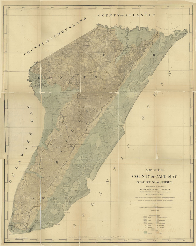
47خريطة
مصطلحات موضوعية: New Jersey -- Geology-- Cape May County, Cape May County (N.J.) -- Maps -- 1857, New Jersey -- Natural history -- Cape May County
وصف الملف: image/jpeg
العلاقة: http://hdl.handle.net/10929/37319Test; https://dspace.njstatelib.org//bitstream/10929/37319/4/Topographical%20Map%20of%20the%20County%20of%20Cape%20May%201857%20SMALLER%20DERIVATIVE.jpg.jpgTest
-
48خريطة
المؤلفون: Scarborough Company of Canada
المساهمون: Great Britain. Privy Council. Judicial Committee
المصدر: Archives and Special Collections
مصطلحات موضوعية: Maps--Facsimiles, Newfoundland and Labrador--Maps, Geography, Natural history
جغرافية الموضوع: Scale [ca. 1:5 450 000]
وصف الملف: 1 map : col.; 37 x 33 cm on sheet 52 x 64 cm; Image/jpeg
العلاقة: Labrador Inuit through Moravian Eyes; other; Is Part Of: The Labrador boundary : Canadian atlas [Ottawa : Government of Canada, 1926], no. 45. Accompanies report of the Judicial Committee of the Privy Council of Great Britain, entitled: In the matter of the boundary between the Dominion of Canada and the Colony of Newfoundland . [London, 1927] 12 v.; LIME_M0049; G 1139.41 F2 L23 1926 OVERSIZE; http://collections.mun.ca/cdm/ref/collection/moravian/id/25715Test
-
49خريطة
المؤلفون: George Philip and Son
المساهمون: Great Britain. Privy Council. Judicial Committee
المصدر: Archives and Special Collections
مصطلحات موضوعية: Arctic regions--Maps, Maps--Facsimiles, Geography, Natural history
جغرافية الموضوع: Scale unknown
وصف الملف: 1 map : col.; 48 x 30 cm on sheet 52 x 65 cm; Image/jpeg
العلاقة: Labrador Inuit through Moravian Eyes; other; Is Part Of: The Labrador boundary : Canadian atlas [Ottawa : Government of Canada, 1926], no. 44. Accompanies report of the Judicial Committee of the Privy Council of Great Britain, entitled: In the matter of the boundary between the Dominion of Canada and the Colony of Newfoundland . [London, 1927] 12 v. -- Original map is plate 21 in Philips' Mercantile Marine atlas, 3rd ed., by George Philip & Son. London : Geographical Institute, 1908.; LIME_M0048; G 1139.41 F2 L23 1926 OVERSIZE; http://collections.mun.ca/cdm/ref/collection/moravian/id/25714Test
-
50خريطة
المساهمون: Great Britain. Privy Council. Judicial Committee
المصدر: Archives and Special Collections
مصطلحات موضوعية: Maps--Facsimiles, Newfoundland and Labrador--Maps, North America--Maps, Boundaries, Interprovincial, Geography, Natural history
جغرافية الموضوع: Scale unknown.
وصف الملف: 1 map : col.; 24 x 21 cm on sheet 52 x 65 cm; Image/jpeg
العلاقة: Labrador Inuit through Moravian Eyes; other; Is Part Of: The Labrador boundary : Canadian atlas [Ottawa : Government of Canada, 1926], no. 40. Accompanies report of the Judicial Committee of the Privy Council of Great Britain, entitled: In the matter of the boundary between the Dominion of Canada and the Colony of Newfoundland . [London, 1927] 12 v. -- Original map is part of map 15 in Indexed atlas of the world, historical, descriptive, statistical, vol. 1. Chicago : Rand McNally & Co., 1902.; LIME_M0045; G 1139.41 F2 L23 1926 OVERSIZE; http://collections.mun.ca/cdm/ref/collection/moravian/id/25711Test
